
The Vía de la Plata Route is a current, cultural and tourist itinerary with a south-north direction that runs through the west of the Iberian Peninsula, from Seville to Gijón/Xixón. Archaeological evidence shows that this route dates back to the Tartessian period (seventh century BC) and Rome used it during the wars of conquest. With Augustus (first century after Christ) this itinerary was consolidated with the construction of different roads that would connect Hispalis with Italica -Via IX of the Antonine Itinerary-, Italica with Augusta Emerita (Mérida) -Via XXIII of the Antoninus Itinerary-, Augusta Emerita with Ocelo Duri (Zamora) -Via XXIV of the Antoninus Itinerary-, Ocelo Duri with Asturica Augusta (Astorga) -Via XXVI of the Antonine Itinerary -, Asturica Augusta with Legio VII (León) -Via Asturica ad Legionem Augusta or Asturica Augusta, and Legio VII with the transmontane lands of the North of the Iberian Peninsula, Lucus Augusti (near Lugo de Llanera) and Noega (Gijón) -Via Carisa-.The itinerary enters Asturias between the municipalities of Aller/Ayer and Lena/Llena, running through the central Asturian area until it flows into the Cantabrian Sea in Gijón/Xixón. Today, this route is signposted as a long-distance itinerary, called GR 100.
Route of the GR 100 in Gijón/Xixón
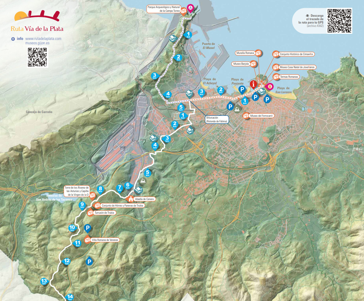
In the municipality of Gijón/Xixón, the itinerary is planned in a north-south direction. Until you reach the place of La Cruciada, in the parish of Cenero, it is an alternative section to the historical route since the original one disappeared when the current Arcelor Mittal factory was installed. If you want to start the itinerary directly in the historical section, you can either take the Feve railway line in the direction of Laviana/Llaviana and get off at the Sotiello station, or take the municipal bus, line 14 to the Abbey of Cenero.
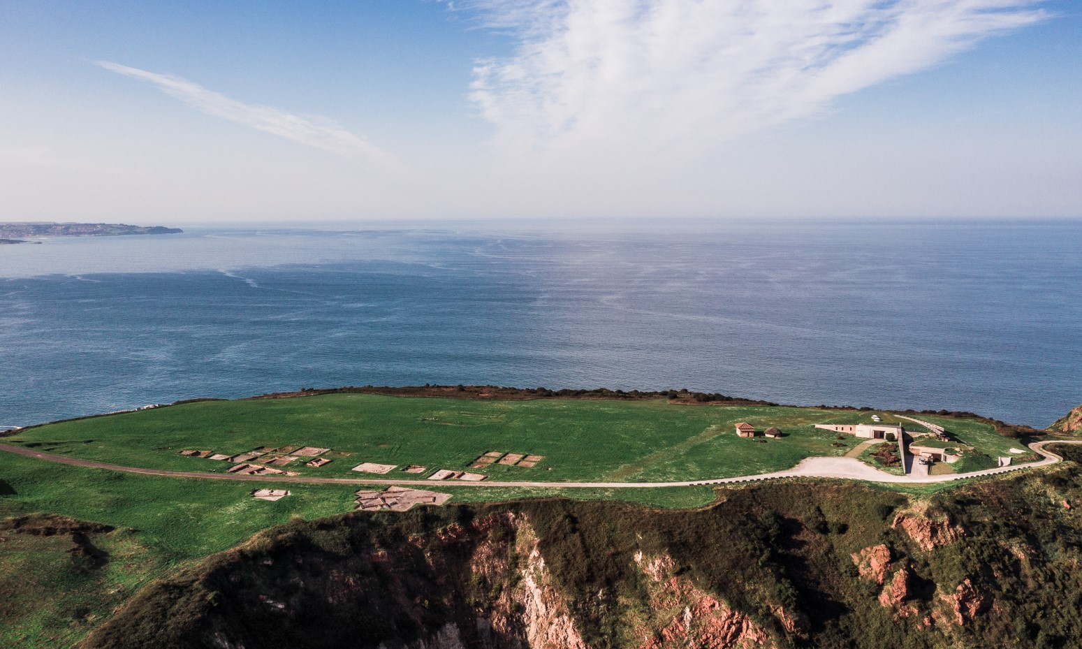
Option A:
Archaeological-Natural Park of La Campa Torres – Roundabout of Fátima. From the Archaeological-Natural Park, where the Campa Torres fort is located, take the Campa de Torres road heading south for more than 4 km until its confluence with the Avilés road (AS-19), where the route turns east until it reaches the Fátima roundabout where it converges with option B of the itinerary.
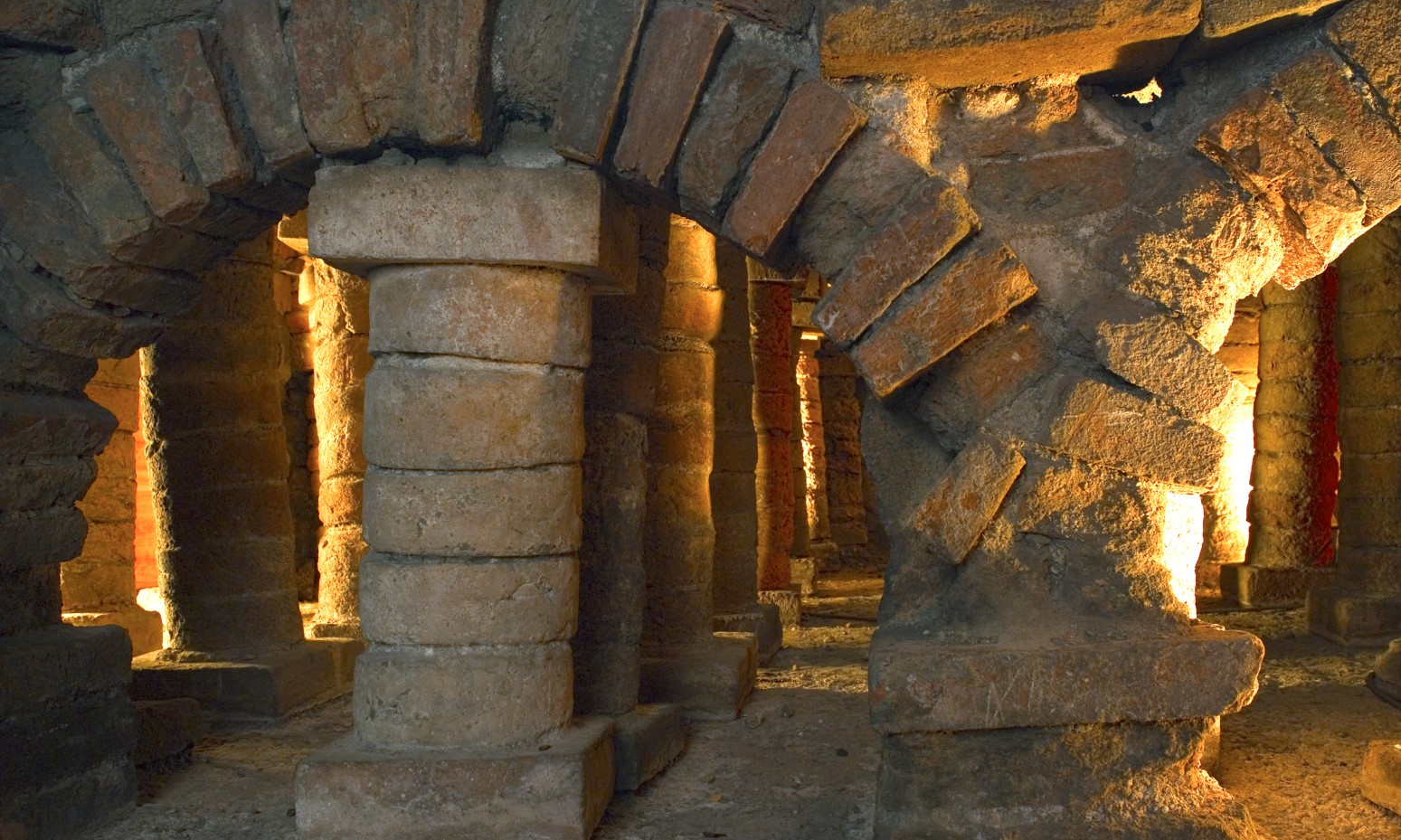
Option B:
Museum of the Roman Baths of Campo Valdés – Fatima Roundabout. Leaving the Baths Museum in an easterly direction and after crossing the Town Hall square, take the promenade, in the vicinity of which is the Barjola Museum. Leaving Rodríguez Sampedro Street behind, you reach the Plaza de Padre Máximo González, take Mariano Pola Street and continue along the Galicia and La Argentina Avenues until you reach the Fatima Roundabout. From the Fátima roundabout following the signs, you leave the city by the overpass over the A-8 motorway in the Lloreda neighbourhood that leads to the Sotiello road. Continuing along this road to the west through the Somonte 2 Industrial Estate, the itinerary leads to the GI-4 heading south. 2 km further on, take the Trubia road that takes you to the Abbey of Cenero.
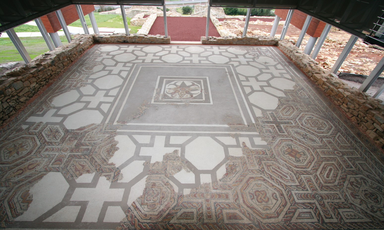
From the Abbey and following the same road, you reach La Cruciada and the Camín del Turruxón. From La Cruciada, the route of the itinerary is adapted to the historical route of the road. The Camín del Turruxón leads us to Trubia. In this place, the towers of the Álvarez de Asturias and the Turruxón de los Valdés are located. Opposite, is the chapel of the Virgen de la O. From Turruxón, the path heads along the Veranes road, until you reach Veranes de Abajo, where you take the Camín del Medio detour in the vicinity of which is the Museum of the Roman Villa of Veranes.
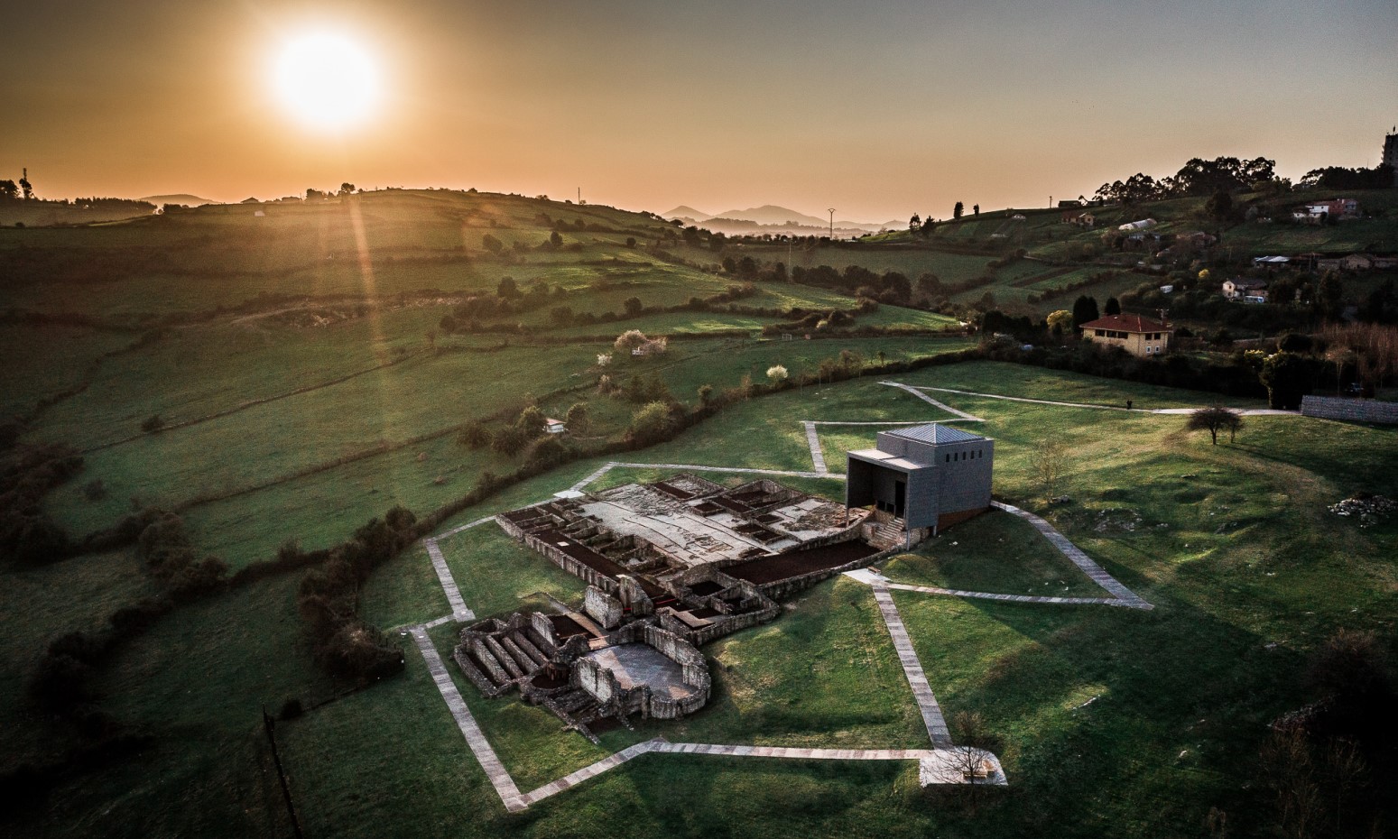
Continue towards Veranes e Arriba for 2 km, to continue along the Batiao road in a southwesterly direction and advance along the Picún road and join the service road of the AS-II (AS-266) in a southerly direction (Oviedo) to Venta de Puga. At this point the motorway is crossed by a footbridge that leads to the Peñaferruz road in an easterly direction until you take the Camín de la Rodriguera. From here you reach the heights of La Rodriguera, where the GR continues, already in the municipalities of Siero and Llanera.

Walked: Itinerary 4 hours 50 minutes
Itinerary B 4 hours 20 minutes
By bike:
Time 2 hours away
Itinerary B 1 hour 45 minutes

Type of pavement:
Asphalt and natural path.
(Final stretch)

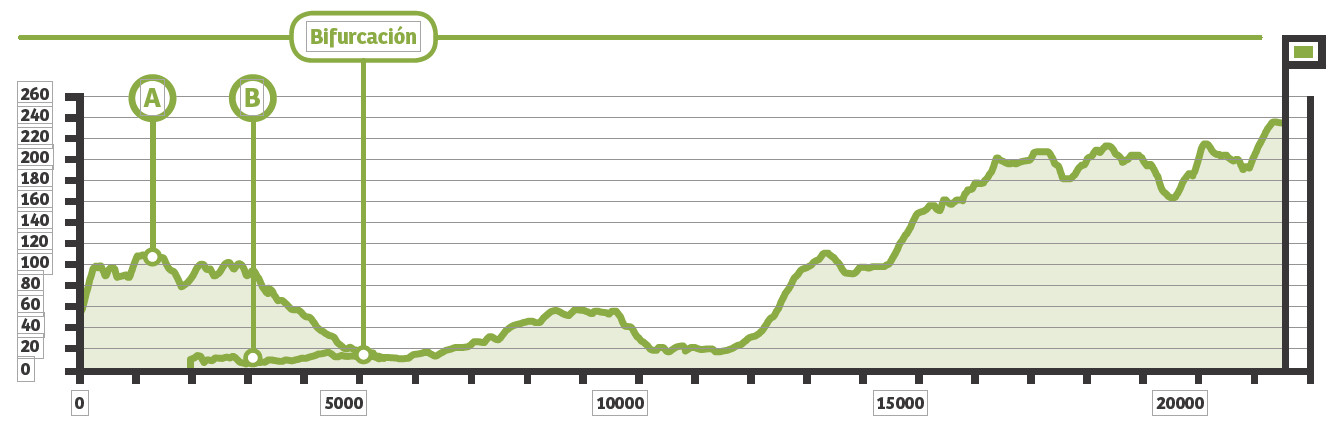
Elevation gain:
Itinerary 365 metres away
Itinerary B 1147 meters
Accumulated elevation gain:
Itinerary 273 metres away
Itinerary B 927 meters